Data from: Building Cultural Heritage Resilience through Remote Sensing: An Integrated Approach using Multi-temporal Site Monitoring, Datafication, and Web-GL Visualization
Data from: Building Cultural Heritage Resilience through Remote Sensing: An Integrated Approach using Multi-temporal Site Monitoring, Datafication, and Web-GL Visualization
About this collection
- Extent
-
14 digital objects.
- Cite This Work
-
Lercari, Nicola; Jaffke, Denise; McAvoy, Scott; Campiani, Arianna; Jiménez Delgado, Gerardo (2021). Data from: Building Cultural Heritage Resilience through Remote Sensing: An Integrated Approach using Multi-temporal Site Monitoring, Datafication, and Web-GL Visualization. UC San Diego Library Digital Collections. https://doi.org/10.6075/J0WH2Q4X
- Description
-
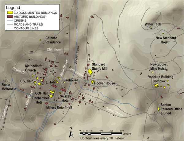
This collection includes multiple remote sensing datasets comprising of geospatial control data, stationary and SLAM terrestrial laser scanning data, aerial photographs, image-based modeling data, and derivative data. The datasets were collected between 2015-2020 at the Gold Rush-era boom town of Bodie, in Mono County, CA. The site is just few mile west of the California-Nevada border. The collection integrates highly accurate 3D snapshots of Bodie's historic buildings before/after disturbance, or post-restoration and other 3D geospatial data that were used to monitor and digitally preserve important cultural resources at the site. The collection was produced as the final output of the 3D Bodie project in 2021. This research initiative was carried out as a collaborative effort between the University of California, Merced and California State Parks in response to recent environmental threats from wildfire and earthquakes at Bodie. Collaborators from the University of California, San Diego Library, Sapienza University of Rome, and the National Autonomous University of Mexico participated in the data processing and analysis efforts.
- Date Collected
- 2015 and 2020
- Date Issued
- 2021
- Principal Investigator
- Co Principal Investigator
- Analysts
- Funding
-
This research was funded by the California Department of Parks and Recreation via Work Order #13-203732-00 and supplement Work Order #13-203732-00R3, by the Resources Legacy Fund, California State Parks Initiative (RLF Grant #2013-0387), and by the University of California Office of the President via a CITRIS Seed Grant 2016. Arianna Campiani's research was funded by the European Union's Horizon 2020 research and innovation programme under the Marie Skłodowska-Curie grant agreement No 839602.
- Geographics
- Topics
-
- 3D
- California cultural resources
- California State Parks
- Climate changes
- Cultural heritage resilience
- Datafication
- Digital site monitoring
- Drones
- Geospatial
- Image-based modeling
- Measured drawing
- Multiscale model to model cloud comparison
- Potree viewer
- Remote sensing
- Surface change detection
- Terrestrial laser scanning
- Unmanned aerial vehicles
- WebGL
Formats
View formats within this collection
- Language
- English
- Identifier
-
Identifier: Arianna Campiani: https://orcid.org/0000-0002-7877-1548
Identifier: Denise Jaffke: https://orcid.org/0000-0002-7974-2167
Identifier: Gerardo Jiménez Delgado: https://orcid.org/0000-0003-2010-3667
Identifier: Nicola Lercari: https://orcid.org/0000-0002-8122-1440
Identifier: Scott McAvoy: https://orcid.org/0000-0001-7810-7025
- Related Resources
- Lercari, N.; Jaffke, D.; Campiani, A.; Guillem, A.; McAvoy, S.; Jiménez Delgado, G.; Bevk Neeb, A. Building Cultural Heritage Resilience through Remote Sensing: An Integrated Approach using Multi-temporal Site Monitoring, Datafication, and Web-GL Visualization. Remote Sens. 2021, 13, 20. https://doi.org/10.3390/rs13204130
- Lercari, N.; Jaffke, D. Implementing Participatory Site Stewardship through Citizen Science and Mobile Apps: The Case of Bodie, California. Advances in Archaeological Practice 2020, 8, 337–350. https://doi.org/10.1017/aap.2020.29
Primary associated publication
Reference
 Library Digital Collections
